Concerns Around Water Quality of Barbers Lake, Long Sault Creek and Nearby Wetlands
How gravel pit construction below the water table
may negatively affect this lake, creek and streams
There is an application by Thomas Cavanagh Construction Ltd to create two sand-gravel extraction pits on either side of Anderson Lane. These pits will be adjacent to Highland Line near Leo Jay Lane. A little further west of this proposed site, Arnott Brothers Construction Ltd. has applied for permission to expand their existing McKinnon Pit at 958 Highland Line and go below the water table.
To better understand how Barbers Lake, Long Sault Creek and adjacent wetlands will be affected by these proposed gravel pits, we are going to explain the basics about water flow above and below ground, water chemistry, changes in water temperature, dissolved solids and suspended solids.
One key point to remember in this discussion is that both companies intend to go below the water table. The second significant point is that both companies will be working on either side of Highland Line adjacent to the pristine wetlands that are part of Long Sault Creek and Barbers Lake in the Township of Lanark Highlands.
What happens when gravel and sand are extracted below the water table?
Two major events happen when gravel and sand are extracted below the water table.
- The groundwater within the sand and gravel is removed or the site is “dewatered,” either by drainage or by pumping. For the sand-gravel extractions proposed by both Cavanagh and Arnott Brothers, the documents say there will be no dewatering by pumping. However, there must be some type of dewatering process undertaken, because the soup-like slurry of sand and gravel cannot be easily handled immediately after it is dredged up, nor can it be easily transported. To this point, neither company has provided detailed information on their dewatering plans, or on how they will go about lowering the water table. This information is critical in order to estimate the environmental impacts on groundwater flows and on connected surface water flows; groundwater flow affects the surface-water flow and vice versa.
- It is presumed that the sand and gravel at these sites are not pure, clean beach sand and gravel. Finer particles, including silts and clay, are likely mixed in with the sand and gravel. As the groundwater in with the sand and gravel is removed, these finer particles will drain out into the environment as suspended solids, and also in some cases as dissolved solids. (Please see the definitions for silt, clay, dissolved solids and suspended solids on pages 5 and 6.)When the levels of suspended solids and/or dissolved solids exceed certain limits, they become contaminants that seriously degrade water quality. In turn, a significant increase in these solids can be lethal or sublethal to downstream aquatic life and vegetation. So far, neither company has provided any detailed estimates or predictions of dissolved solids and suspended solids expected in their dewatering, surface-water discharges and groundwater flows. As explained below, suspended solids and perhaps dissolved solids may be increased substantially, even to contaminant levels, by the proposed extractions of sand and gravel. Nobody knows what will occur at these extraction sites because this issue regarding suspended and/or dissolved solids has not been studied in detail by either company.
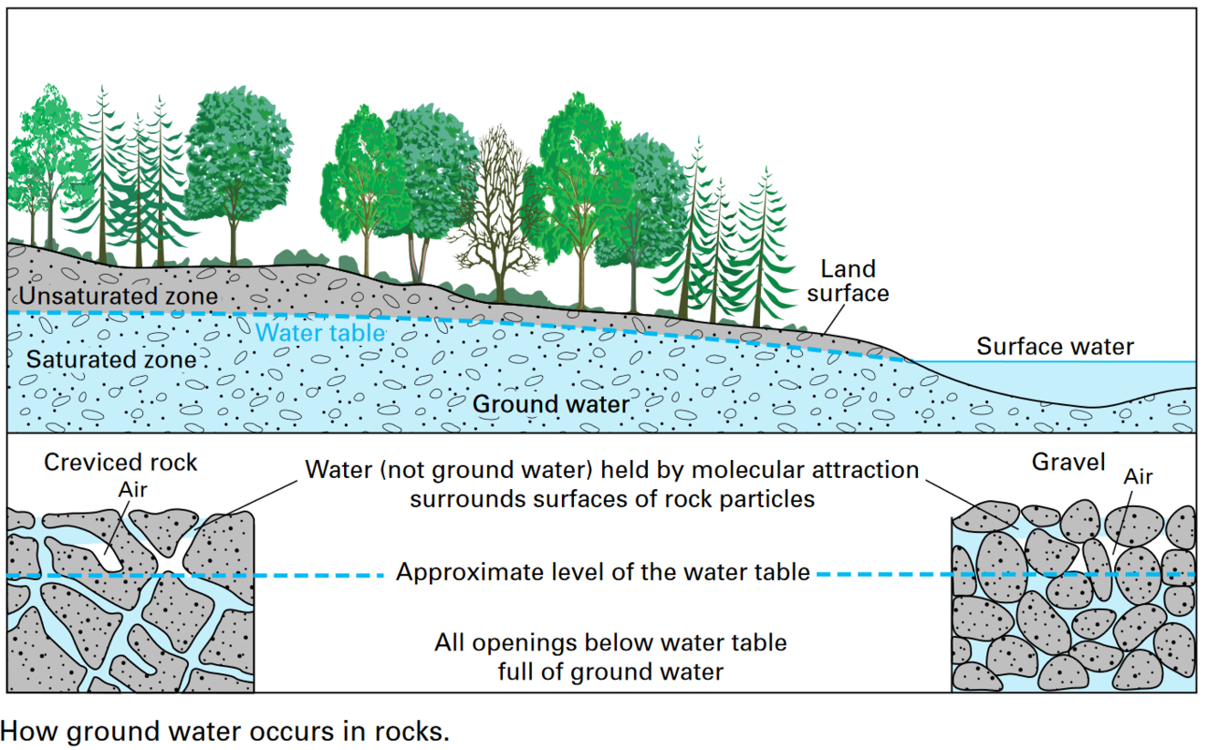
The above diagram explains how groundwater occurs in rocks.
What is surface water?
Surface water is that water found in ponds, lakes, inland seas, streams and rivers.
What is groundwater?
Groundwater is water that is found in underground cracks and spaces in the soil, sand and rocks. This groundwater may come from precipitation or from underground water flowing in an aquifer. The rate of groundwater flow depends on the size of the spaces in the soil or rocks, how well the spaces are connected and the water pressure.
What is an aquifer?
An aquifer is rock or sediment that is saturated and sufficiently permeable to transmit economic quantities of water to wells and springs. In other words, aquifers contain groundwater. This is a bit confusing as groundwater is always underground! The key point to remember is that an aquifer transmits the groundwater relatively quickly. Where an underground formation transmits groundwater fairly slowly, it is called the aquitard.
What is the water table?
The water table is the uppermost layer of water at which the soil spaces are saturated with water. The groundwater table can be measured by installing shallow wells extending a few feet into the zone of saturation and then measuring the water level of those wells.
When the water table is above the ground, springs, rivers, lakes and wetlands occur. Seasonal changes in precipitation and evaporation can alter the water level above and below the ground.
Going below the water table
In the Level 1 and Level 2 Water Report by their consultants Golder, Associates Ltd., Cavanagh Construction has stated that “[t]he extraction will include the removal of overburden materials to an approximate pit base elevation of 176 meters above sea level.” The report goes on to claim that “[t]he ground surface elevation within the site area ranges from approximately 184 to 216 meters above sea level.” According to their calculations, “[g]roundwater depths range is from 1.5 to 4.6 meters bgs across the site.” (Note: bgs is the abbreviation for below ground surface.)
Arnott Brothers is proposing to excavate down to 173 meters above sea level.
Surely there will be some method of dewatering because the final water levels are lower than the initial water levels, but this is not explained in their reports.
Moreover, the volume, quantity and quality of this dewatering needs approval by regulatory agencies.
Why has neither company acknowledged that water will be removed? If there is no dewatering, where will the water in the pit holes go as they dig downward?
In the case of the proposed Cavanagh extraction sites, the surface runoff and the groundwater infiltration may likely contain elevated levels of suspended solids and potentially elevated levels of various dissolved solids that could disrupt and compromise Barbers Lake, wetlands, creeks and the underlying groundwater. Moreover, with the water in the Cavanagh pit at a flat elevation of approximately 180 meters above sea level, Barbers Lake will not longer be fed by much if any groundwater, which will change the water quality, the food chain and the aquatic life and vegetation around the lake, nearby wetlands and downstream creeks.
What type of minerals will be contained in these suspended and dissolved solids? Who will monitor these finer particles? Who is responsible for remediation if any of the qualities measured go outside the acceptable levels?
Cavanagh plans to openly discharge water of unknown quality into Barbers Lake through an outlet forever. Arnott Brothers has not stated how and where they will discharge their runoff water. Government agencies need to ensure that, for all flows and water qualities, all local surface waters and groundwaters are:
(1) monitored weekly as a baseline for at least one year before any new extraction starts;
(2) monitored weekly for the entire duration if extraction is approved; and
(3) monitored weekly for at least two years after extraction ceases.
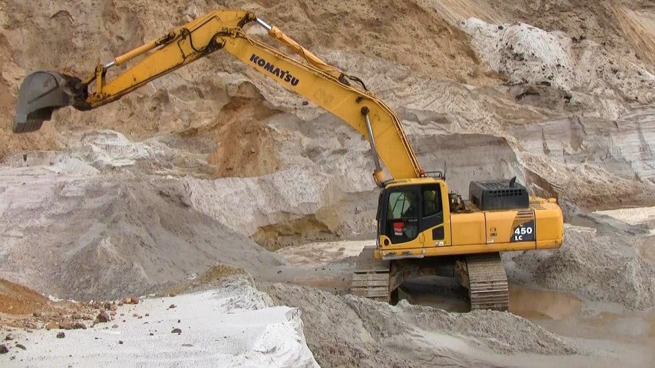
These gravel pits are adjacent to a lake fishery
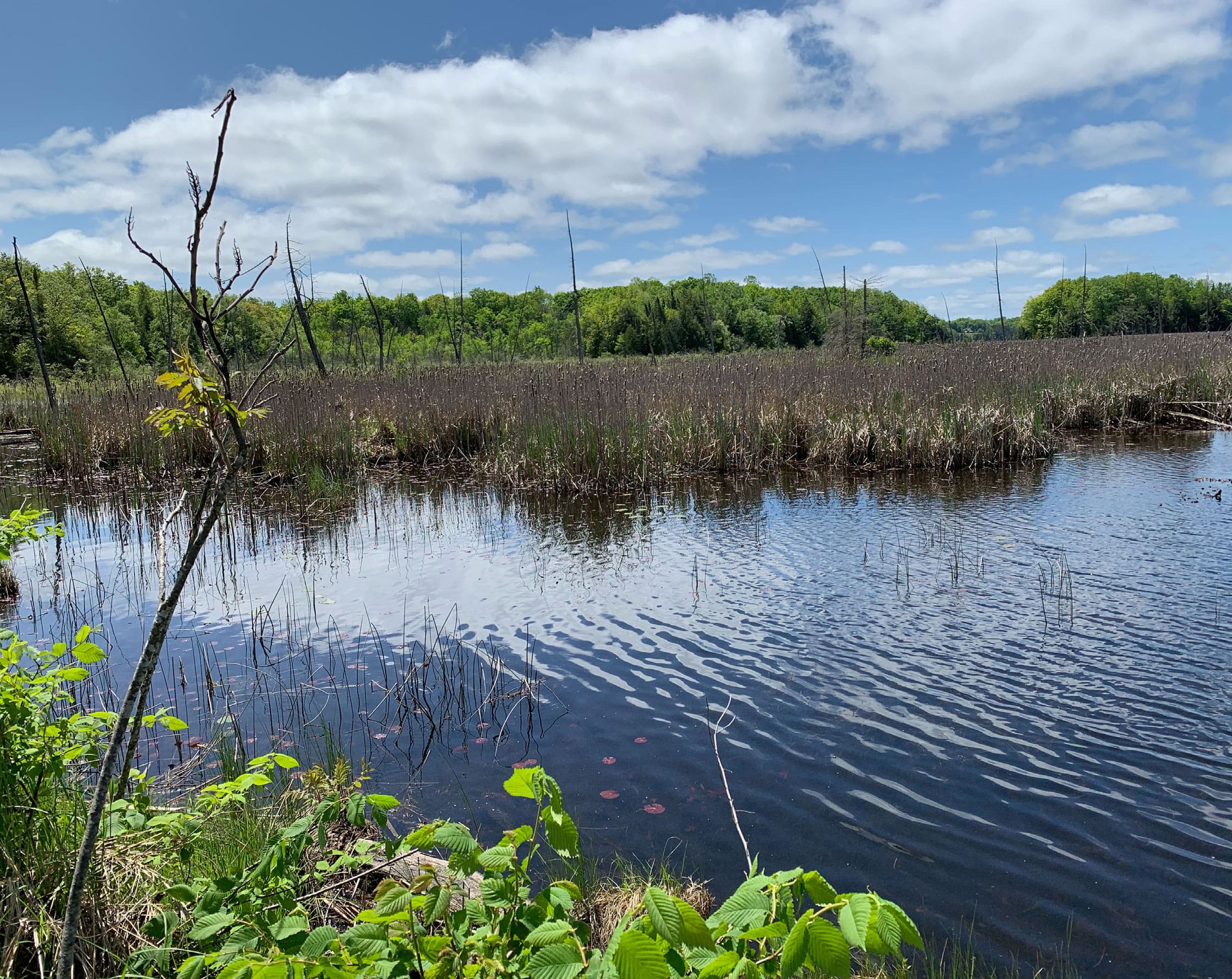
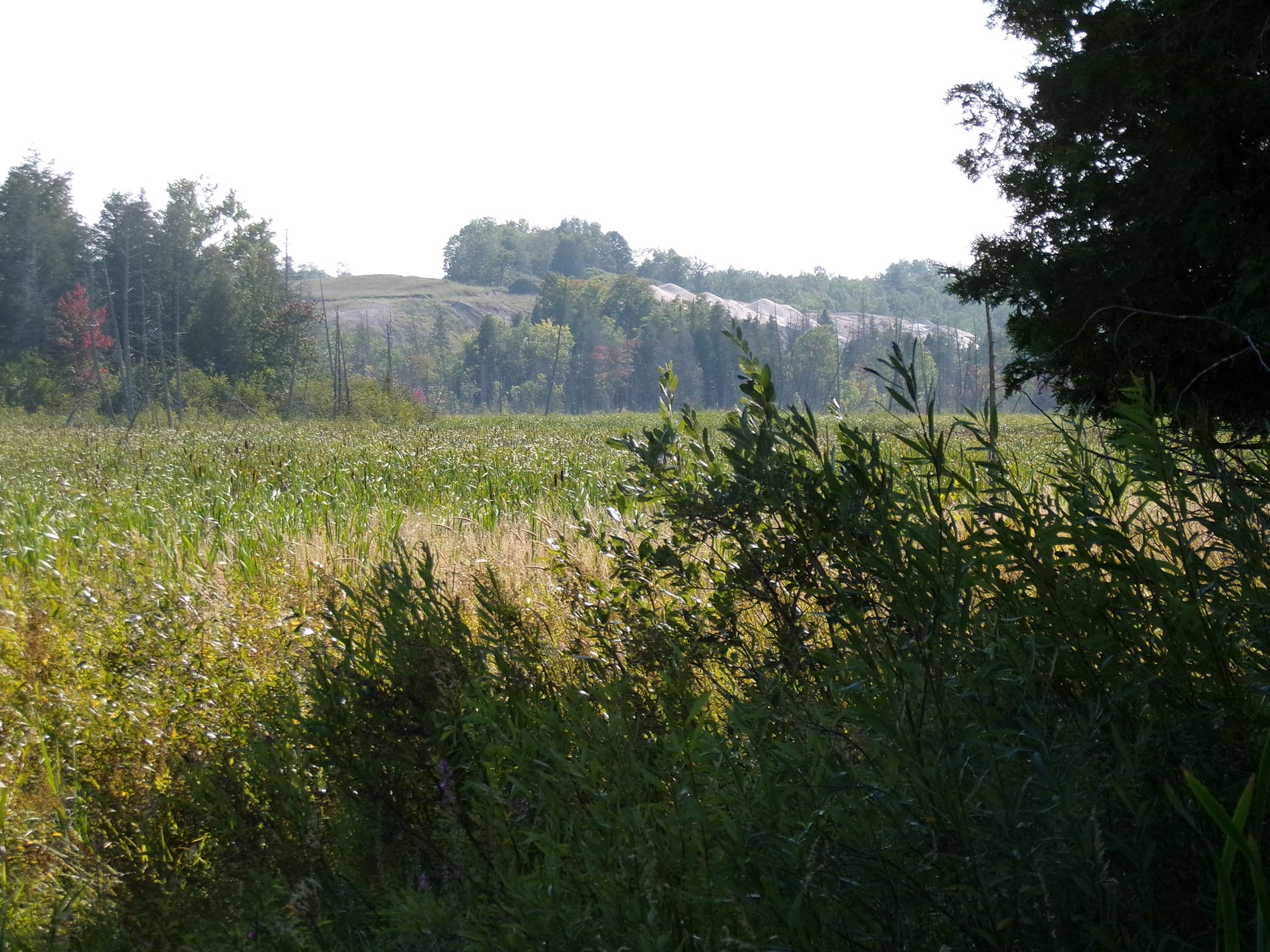
The proposed Cavanagh extraction zones would be adjacent to Barbers Lake which is a lake fishery; the existing McKinnon Pit is adjacent to wetlands, which drain into Long Sault Creek, 1.4 kilometres downstream from Barbers Lake. This vibrant lake is used throughout the entire year. Bass, pike, perch, sunfish, catfish and others live in this lake. Fishers come from near and far to take part in mostly catch-and-release fishing. The lake empties into one of the several streams called Long Sault Creek, and because of its cooler temperatures, this particular stream bed is a breeding ground for trout. It is the only breeding ground for coldwater trout in Lanark County.
One of the key concerns related to this fishery is the potential warming of Barbers Lake and adjacent stream beds due to the warm runoff waters coming particularly from the proposed Cavanagh excavation site.
In section 6.3 titled Fish Habitat on page 19 of the Golder Associates Natural Environmental Report, December 2022, prepared for Cavanagh Construction, the following statement is made: “Under operational and rehabilitation conditions, runoff volumes to Barber’s Lake are expected to decrease as a result of catchment loss, however, an outlet to Barber’s Lake will be placed at the east edge of the proposed pit (at an elevation of 186 masl) to offset the loss of runoff.” [Note: masl is the abbreviation for meters above sea level.]
Accordingly, the fine particles dredged up at their two extraction pits on either side of Anderson Lane would leave the area on an ongoing basis – even long after the pits are closed down. They could clog up the wetlands and watercourses and shut down photosynthesis.
In addition to the fine particles of sand and silt, biological organisms will also be carried from the sites. Waters flowing from the outlet toward and into the lake will no longer be filtered by the natural groundwater system and instead carry fine particles and biological organisms. They will also bring significant temperature variations. This infusion could seriously degrade the existing aquatic life and ecosystem in these waters.
Cavanaugh has not defined what type of outlet it proposes to install into Barbers Lake.
Will there be a ditch? Will it be a drainage pipe? What size of diameter? Where will it be placed? How far will it extend into the lake? How will its contents be monitored?
Arnott Brothers Construction has not discussed where or how they intend discharge surface runoff. If a berm is installed without a discharge pipe, the dam will eventually wash out and the pit lake will decrease in elevation and flow into the surrounding wetlands.
The challenge from a public dialogue point of view is that applications for “dewatering” of any kind are made AFTER the pit is given the licences to operate by the Ministry of Natural Resources and Forestry. Those licenses then go to the Ministry of the Environment, Conservation and Parks. This flaw in the licensing procedure would set up the companies to be approved but their business plans are then reliant on this secondary procedure to apply for a dewatering licence.
In summary, regardless of the bureaucratic procedures, fine particles coming from all these extraction sites would settle on the bottom of the creeks, streams, wetlands and lake. They would also remain suspended in the water column and as a result slow down or stop photosynthesis in these waters. The absence of photosynthesis would eventually curtail all life forms in the lake. Barbers Lake would die.
What types of water quality tests will be undertaken by both companies on Barbers Lake and the streams and the wetlands that comprise Long Sault Creek? How often will these tests be done and over how many years? When will these test results be available to the public? Who is responsible if the parameters measured deviate from acceptable levels?
What is silt and clay?
Silt and clay are particles finer than sand. The proposed extraction of sand and gravel will likely include silt and/or clay particles, because the sand is not pure. These finer particles can be either stirred up and suspended in water as suspended solids, or they can be partially dissolved in water as dissolved solids. Sometimes a water column contains both suspended and dissolved solids. In any of these situations, the water quality can be seriously compromised, leading to adverse impacts on downstream aquatic life. No detailed estimates or predictions on suspended solids or dissolved solids can be found in either company’s documents.
What are suspended solids?
During the extraction of sand and gravel using power shovels or dredges, the silt and clay within the sand and gravel become disturbed and “stirred up.” This causes the silt and clay to become suspended in the water that drains off the site. In simple words, the water becomes cloudy or muddy. This mud can be compared to the mud on a car after it has been driven on a gravel road after a rainstorm.
Several adverse and toxic effects can occur when water with high amounts of suspended solids enters a lake, wetland or creek. For example, suspended solids block some of the sunlight from entering the water column. This can slow down or stop photosynthesis, both in the water column and on the bottom of the lake or stream
bed. As described above, less photosynthesis means less oxygen is produced. Lack of oxygen places pressure on the fish, turtles, amphibians and insects living in the water column. In summary, the basic starting point of the food chain may become impacted, and the entire ecosystem becomes affected and degraded.
As another example, suspended solids can settle to the bottom where they can cover up the existing vegetation and bottom-dwelling (benthic) communities, which include a wide range of plants, fish, reptiles (turtles), amphibians (frogs and salamanders) and bacteria from all levels of the food web. Here again, negative impacts to these benthic communities will lead to adverse effects all the way up the food chain.
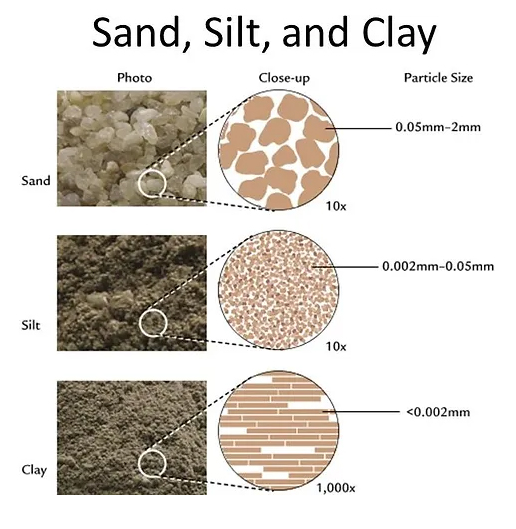
Suspended solids in water are a major environmental risk at sand-gravel extractions. For the proposed extractions along Highland Line, suspended solids have not received significant attention in either company’s documents or by regulatory agencies. The potential for lethal effects to Barbers Lake, Long Sault Creek, adjacent wetlands, and streams is currently unknown, but should be a critical consideration.
What are dissolved solids?
Dissolved solids are different from suspended solids, yet they are still a risk to the environment if their levels are too high. Suspended solids cause the water to appear cloudy or muddy, while dissolved solids are typically invisible, much like table salt dissolved in water. Each site can create different levels of dissolved solids, so detailed site-specific tests need to be conducted to estimate these levels. This testing has apparently not yet been done by either construction company, or by their consultants.
How gravel acts as a filtration system
Cavanagh Construction and Arnott Brothers Construction both propose to extract gravel deposits which contain sediment and clay. Together these substances act as a massive filtration system, greatly cooling and filtering the rainwater that would otherwise flow directly into Barbers Lake, the adjacent wetlands and creeks, as well as into underground aquifers. As this gravel and sediment are removed, there will be a major shift in the chemistry of both the surface water and groundwater and a dramatic alteration to their normal temperatures. The removal of this deep, thick natural filtration system would also create an ecological shock to the plants and animals living in the surrounding waters. Eventually the lake and creek will become impoverished and degraded.
Additionally, extraction below the water table will expose the groundwater to air, bacteria and other microbes, and to major temperature fluctuations that the overlying soil and sand-gravel mixture would otherwise regulate. This can lead to the biological degradation of water quality and an adverse impact on Barbers Lake, the wetlands, creeks, streams and the cold-water fish nursery. The existing deep filtration system for groundwater will be replaced by open water and ponds draining into the surrounding environment. These waters will no longer be protected from airborne and waterborne contaminants and temperature fluctuations.
Barbers Lake has a relatively slow water recharge capacity. This means it takes a longer time for water in Barbers Lake to adjust to minor and major changes. As stated earlier, the silt and clay will wash out of the mined gravel as it is being dug up from underground deposits, and these particles may end up in the lake and surrounding wetlands and streams. The wetlands surrounding the McKinnon Pit owned by Arnott Brothers will be similarly affected.
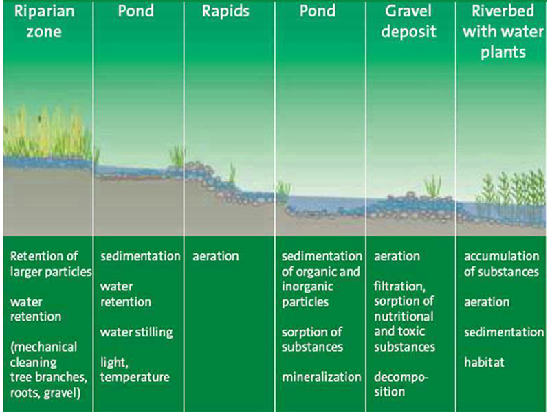
Being fine sediments, these particles will not simply sink. Instead, they will spread out and cover the lake bed and wetland floor and suffocate anything growing there. Plant life, filter feeders such as clams, and the whole food chain that keeps this lake and surrounding wetlands alive will be cut off at the root, so to speak. The lake and wetland ecosystems can be expected to die from these suspended solids.
What is the proposed mechanism to prevent washout of fine particulate from the mined sediments from choking out Barbers Lake, the adjacent wetlands and Long Sault Creek?
What alternative deep-water filtration system has been proposed by both companies to replace the functionality of the natural filtration system that the gravel deposits provide? How will they prevent a rise in temperature and a degradation of surface-water and groundwater quality?
Additional contaminants to be stored on site by both companies
At the public presentation on April 27, 2023, chaired by the Cavanagh consultant, it was stated that the company plans to store asphalt on their proposed pit site. In their Operations Plan, Arnott Brothers have stated that recycled asphalt pavement is to be permitted on the site. There is no mention of water quality studies of adjacent wetlands and streams to monitor runoff from these storage sites.
How can these companies assume the surrounding waters will remain clean?
It is a given assumption that there will be a significant amount of suspended solids flowing from all extraction sites into nearby wetlands and Barbers Lake. To clean these surface waters from suspended particles, one needs a water treatment plant. In their reports, neither company includes discussion about a water treatment facility. Moreover, a permit is required for installing such a treatment facility, and this also is not discussed in either report.
Setbacks and ecological significance of adjacent wetlands
While the Cavanagh Construction setback for adjacent wetlands is only 30 meters, Arnott Brothers claim they are treating their adjacent wetlands as being provincially significant and are giving a setback of 45 meters.
Section 5.3.2.4 of the Township of Lanark Highlands Official Plan states the following:
Development within 120 meters of a Provincially Significant Wetland or development or lot which includes a wetland or part of a wetland must take place outside of the wetland area and such development shall be subject to the preparation of an Environmental Impact Statement which demonstrates that there will be no negative impacts on the natural features or ecological functions of the wetland.
Is the Township of Lanark Highlands prepared to treat these wetlands as Provincially Significant Wetlands?
Water balance
According to the Arnott Brothers Construction application, the assumption is made that the daily amount of water moving into the extraction site as rainfall will equal the amount of daily water evaporation. And yet in late July of this year (2023) in Halifax and central Nova Scotia, an estimated 250 millimeters (9.8 inches) of water fell within two days.
Has either company planned for extreme weather events and climate changes? What remediation measures will be taken if extreme rainfall occurs?
In a worse-case scenario of an extreme rainfall, the excess water in these extraction sites will spill over and this water containing suspended and dissolved solids will end up in nearby streams, wetlands and Barbers Lake and severely comprimise these waters and the living organisms they contain.
The presence of uranium in the bedrock
Elevated levels of radioactive uranium have been identified in the bedrock beneath this area. Upward-welling and/or flowing groundwater from the bedrock could carry dissolved uranium into the overlying sand and gravel. In the case of uranium, exposing the sand and gravel and the underlying rock to air or aerated water, as would occur during the proposed extraction process, can accelerate the leaching of uranium and other heavy metals. This could reach the point of creating toxic levels of dissolved uranium and other heavy metals. The silt and clay that will occur as suspended solids may also carry some of this uranium as suspended uranium.
Without detailed and careful testing, the environmental effects of dissolved solids from the proposed extraction of this sand and gravel remain unknown. Laboratory and on-site methods for estimating dissolved solids have been known and used for many decades, but they have apparently not been conducted by either applicant.
Water quality in nearby residential and commercial wells
Monitoring water quality and water levels in nearby residential and commercial wells is a task that needs to be part of the protocol undertaken by both companies on an ongoing basis. There needs to be a written and signed contract with homeowners to ensure clean water is provided at company expense if private wells become contaminated.
Conclusion
In Ontario, sand and gravel operations do not fall under the provincial Mining Act. Instead these open pits fall under the Aggregate Resources Act, where there is less scrutiny of water quality. Given the complexity of concerns around water quality described above, these particular sand-gravel extraction applications by Cavanagh and Arnott Brothers clearly require greater scrutiny.
Details on dewatering methods, monitoring of the fish habitats, detection of and monitoring for uranium, determining levels of suspended and dissolved solids in surface water and groundwater all need to be fully understood BEFORE these projects begin. In addition, mitigation measures to avoid the risk of losing these valuable natural resources need to be clearly defined.
Prepared by Save Long Sault Creek.ca
September 2023
Updates & Articles
Recycled Concrete Aggregate is The Way to Go
One neat thing about this product is that it involves re-using waste materials that might otherwise go to a landfill site. Another bonus…
Read MoreHuman Impact on Blanding’s Turtles
Like most if not all the seven species of turtles in Ontario, the Blanding’s turtle is threatened by the loss of their habitat through ever expanding human development and by roadside mortality.
Read MoreBald Eagles Near and Far
A couple of weeks ago, I was getting bird food at a specialty store in Kanata. The shop has its own TV screen, and on it was a livestream youtube video of a bald eagles’ nest in California…
Read MoreRock Sample Analysis Presentation by Linda Harvey
Review Linda Harvey’s presentation on the rock sample analysis.
Read MoreCalling all artists to paint to support creek
On the first Saturday of October, Save Long Sault Creek.ca is hosting an outdoor painting session where Barbers Lake flows into Long Sault Creek.
Read MoreBaby Brook Trout Thriving in Long Sault Creek
Young Brook Trout captured and released from Long Sault Creek at Milton Road.
Read More
